Search this site
- Enjoy Darwin
- Kakadu Maps
Kakadu Maps
Several Kakadu maps to display location, tourist information and a live Google map of Kakadu. This is a large area and you will benefit from knowing where everything is and travel times involved.
 Darwin to Jabiru is 250 kilometres. Jabiru to Pine Creek is 205 k's. Both roads are sealed.(blue lines)
Click the Thumbnail to see the most detailed map of tourist facilities, roads, waterways and places of interest in Kakadu.
There
are extremes of weather and totally different conditions in the park at
different times. Many unsealed roads and tracks are under water in the
wet season, so check on local conditions before you travel.
Printed maps are available at several visitor centres in the park, or from the Tourist Centre in Bennett St Darwin.
And the map I like best should have loaded below for you by now. Use the live Google map to zoom around the area, switch to "Sat" to see satelite images and get a feel for just how big and isolated Kakadu is.
More on Kakadu National Park here...
Return from Kakadu Maps to Enjoy Darwin Home.
Recent Articles
-
Acacia Dental Clinic
 Acacia Dentistry Care is committed to providing all dental care services all over the world. We all know that dentist care is expensive, but the services
 -
In Vogue Dancing
 With Linda and Murray (Darwin NT ) InVogue Dancing Come and enjoy our weekly mix of Standard Ballroom and Latin American dances - mainly Sequence, some
 -
The Outsiders: RoofTop Party
Step into the extraordinary with The Outsiders: RoofTop Party dance party, where the allure of the night invites you to flaunt your most impressive attire. -
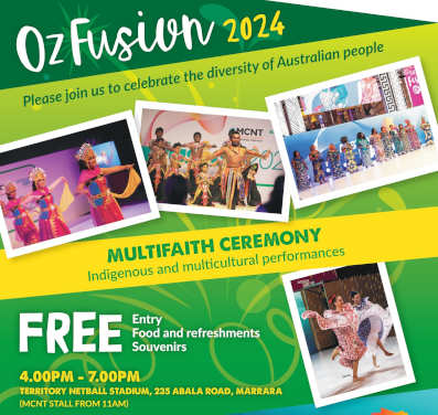
Darwin 2024 Calendar
 The Darwin 2024 Calendar of sports, festivals, markets, open days and just about anything else that is happening around Darwin this year.


日本語のダーーウィン情報を探しののははここららのサイををごごご覧
「ようこそダダーウ」
Darwin Community
Add your own Information or Comment on Articles in these Community Pages.
Community
- Art & Craft
- Clubs & Groups
- Community Forum
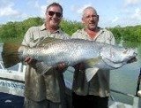
- Fishing
- Fishing Clubs
- Musicians
- Social Dancing
- Sports & Recreation
- Survival Guide
- Venues for Hire
Buy/Sell
History

 Community Banks® return profits to the community.