Search this site
- Enjoy Darwin
- Boat Ramps
Darwin Boat Ramps
Several Darwin boat ramps are provided for public use and are popular places for fishermen and for others just enjoying the fresh sea breezes or fishing from the shore.
Nightcliff Boat Ramp
 No water - Nightcliff ramp at low Tide
Perhaps the best known is the Nightcliff boat ramp and jetty, located along the cliffs at the end of Casuarina Drive.
On a Saturday afternoon this is a busy spot, with food caravans providing take-aways for the many who come to enjoy the setting sun, cool breezes and green parks and playgrounds.
More photos and Tide Information
Tidal Access: Above 2.5 metres.
Buffalo Creek Boat Ramp
 Looking towards the creek sand bar.
Buffalo Creek boat ramp is further from the city, turn right past the Lee Point Caravan Park. A permanent kiosk supplies food, drinks and some fishing supplies for those using the ramp or just enjoying the wide tidal sandy beaches.
Tidal Access: The creek is accessible at all tides, however about 4m or more is needed to cross the creek entrance.
Palmerston Boat Ramp
 Fishing from the Jetty at the Palmerston Boat Ramp and Jetty
A newly developed ramp area at Palmerston, just beside the Elizabeth River Bridge has a floating pontoon, a fishing jetty, new public toilets and plenty of parking space.
 Cleaning bay, toilets & access ramp
Facilities at the Palmerston ramp are well-lit, with a cleaning bay, toilets, a wheelchair access ramp and plenty of parking space.
Tidal Access: All tides.
About 9k from the Stuart Highway, it's worth the drive just for the scenery along the river.
 Powerlines cut the evening sky with Darwin in the distance
East Arm Boat Ramp
 Twin boat ramps at East Arm
 Facilities at East Arm Boat Ramp
East Arm Ramp located at the end of Berrimah Road in the rapidly growing industrial East Arm port. Follow Berrimah Rd. to Casey St. just before the Port, on the left.
A large parking area, toilets, shaded tables and good lighting make this a popular ramp.
Tidal Access: Most tides.
Dinah Beach Boat Ramp
 Modern housing overlooks
Dinah Beach ramp
Modern housing overlooks
Dinah Beach rampThe Dinah Beach Ramp on Francis Bay Drive is close to many of the boating services in Darwin. From Tipperary Waters to the Fishermans Wharf and the Darwin Harbour precinct, Frances Bay is the main centre of boating commerce and facilities.
Tidal Access: Above 2.5 metres.
Vestys Beach and Doyles Ramps
 The resurfaced Vestys Beach ramp is dry....
 ...while a tinnie is launched at Doyles
Vesteys Beach Ramp and Doyles Ramp are located on the foreshores of Fannie Bay only about 500m apart. Access to Vestey's is via Atkins Drive, Doyles via Conacher St between the Darwin Museum and the Ski Club.
Tidal Access: Vesty - above 3.5 metres, Doyles- above 2.5 metres.
 Members only at the DTBC and Darwin Sailing Club
Also sitting side by side on Fannie Bay, both the Darwin Trailor Boat Club and the Darwin Sailing Club have boat ramps, however these are only available to club members
Regional Boat Ramps
The following ramps are some distance from the metropolitan area, take adequate provisions and care.
Channel island Boat Ramp
 Channel Island boat ramp
 Turbulence warning at ramp
Channel Island boat ramp is located right at the end of the road next to the Darwin Aquaculture Centre.
This is one of the oldest ramps in Darwin and one of the trickiest to use. Note the on site sign warning of possible turbulence.
Tidal Access: most tides
Dundee Beach Boat Ramp
 Breakwater and boat ramp with Dundee Lodge in the background
Dundee Beach is a small community on the coast about 2 hours drive from Darwin. It is a popular spot for fishos and Dundee Lodge provides accommodation, fuel, food and a licensed bar.
Tidal Access: all Tides
This is a relatively new ramp and breakwater, you can see a smaller, older concrete ramp between the trees on the right side of the main ramp.
Six Pack Creek Ramp
 Six Pack Creek boat ramp
Located at the end of a stretch of reasonable dirt road, this is one of the more remote ramps not too far from Darwin.
Tidal Access: above 2.5m
There are no facilities other than the concrete ramp and a graded flat area for parking at the top of the ramp.
Access via Fogg Bay Road>Barramundi Drive> Javelin Road.
Manton Dam Ramp
 Manton Dam is a freshwater recreation area.
About half an hour down the track from Palmerston, Manton Dam was the main water supply for Darwin prior to the Darwin River dam being built.
There are public toilets and BBQ's available around the lake and the water is stocked with barramundi for the keen fisherman. Swimming is permitted as it is unlikely that saltwater crocodiles would make their way upstream past the dam wall.
The original pump station can be viewed at the dam wall which is a few kilometres back towards Darwin, just off the Stuart Highway.
Southport Boat Ramp
 Southport Boat Ramp
Located off Kersley St. Southport, not far from Berry Springs Village
Tidal Access: above 3m
There are no facilities other than the concrete ramp and a graded flat area for parking at the top of the ramp.
Southport was a busy place in the early days of the NT, but was bypassed by the railway and largely forgotten. Now it is just home to a few residential blocks, with modern Berry Springs Village providing services, along with a new Tavern and petrol station.
 Adcocks Store and Jetty, Southport 1878
An information display beside the boat ramp provides information and photos from that early time in the Northern territory.
Leaders Creek Public Ramp
 Leaders Creek public boat ramp. (off Gunn Point Rd.)
Access to this ramp is now much easier with the (almost completed) upgrade and sealing of Gunn Point Rd. There now only a few k's of good quality dirt to navigate.
Tidal Access: above 2m
Leaders Creek provides good access to Vernons, Melville and Ruby Islands, Cape Hotham, the Blue Holes, Salt Water Arm and the mouth of the Adelaide River or 15Kms of sheltered waterways.
Next to the ramp, camping and facilities are available at the Leaders Creek Fishing Base
Middle Arm Ramp


There is sealed parking space for around twenty trailers at Middle Arm Ramp however several k's of dirt separate the ramp from Finn Rd.
Tidal Access: Most tides but difficulties may be encountered at low water.
Mandorah Boat Ramp and Jetty
 Mandorah Boat Ramp and Jetty 2019
 Extensive parking area at the Jetty
Directly across the harbour from Darwin CBD, the jetty and boat ramp are connected to the city by a ferry service from Cullen Bay.
This provides a link for the residents of Wagait Beach which is about 130k's from Darwin by road, but only 15 minutes on the ferry.
The NT Government has scheduled a redevelopment of the jetty and ramp, expected to be completed in mid 2020.
Return from Darwin Boat Ramps to Enjoy Darwin Home.
Recent Articles
-
NTFL Womens Premier League 2024-25
 NTFL Womens Premier League 2024-25
 -
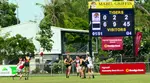
NTFL Games - Mens Premier 2025-2026
 NTFL Games for the Men's Premier 2025-2026 season. The Darwin football season runs from October to March while the southern states are in recess.
 -
2010 Toyota LC200 VX
 For sale is a 2010 landcruiser vx. Located in Gunn NT. Not needed anymore. 156,000kms, price $50k. Contact Nathan 0401500382.
 -
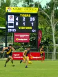
NTFL Mens Premier Ladder 2025 - 2026 Season
The NTFL Ladder for the 2025 - 2026 season is updated weekly showing how the Northern Territory Aussie Rules clubs are progressing through the Darwin football season.


Darwin Community
Add your own Information or Comment on Articles in these Community Pages.
Community
- Art & Craft
- Clubs & Groups
- Community Forum
- Fishing
- Fishing Clubs
- Musicians
- Social Dancing
- Sports & Recreation
- Survival Guide
- Venues for Hire
Buy/Sell
History

 Community Banks® return profits to the community.