Search this site
- Enjoy Darwin
- Darwin Suburbs
Darwin Australia - Suburbs and Localities Guide
Darwin
Australia Suburbs and Localities guide - locations, shopping, banks,
accommodation and general information for Casuarina, Nightcliff, Stuart
Park and other Darwin suburbs
 Casuarina Square, Trower Road entrance
Quick facts list for Darwin
Darwin Bank Locations
Darwin Maps
Darwin Tourist Attractions
Many of the suburbs listed here are quite small with only a couple of thousand residents and small commercial or retail sectors. This is how Darwin is known locally and is not an official municipal description of boundaries or locations.
The larger towns of Palmerston and Coolalinga have more information on their own pages.
Alawa 0810
A small, quiet area located close to Casuarina Shops, the University and the parks around Rapid Creek. A bike path connects to Nightcliff and Casuarina Beach and a community garden is being developed along Lakeside Drive for those with a green thumb.
Alawa Primary School; Alawa Pre-school; Hairdresser; Cake Shop; Greek Club; Gymnasium; Health & Beauty Salon; Take Away Foods
Anula 0812
On the eastern side of Lee Point Rd, a very green suburb with lots of parks and bike paths and a small group of shops.
Anula Primary School
Take away foods
Salvation Army Hall
Bayview 0820
 Bayview
This
is one of the newer areas, with great views of Francis Bay and Darwin.
City.
Berrimah 0828
On the intersection of the Stuart Highway and Berrimah Rd, not many years ago this was the outer extent of Darwin, now it is a central point between Darwin and Palmerston with new stores replacing the old caravan parks
Brinkin 0810
 Brinkin borders Casuarina Cliffs
Overlooking Casuarina Beach and next to Charles Darwin University, this is one of the most highly prized areas of Real Estate in Darwin.
Casuarina 0810
The retail hub of the suburbs in two large air-conditioned shopping centres, with all major services, a cinema, swimming pool, sports club and more.
Coconut Grove 0810
A mixture of houses, flats, light industrial and retail services on the city side of Nightcliff and bordering the modern Nightcliff Shopping Centre
Coonawarra 0820
HMAS
Coonawarra Naval Base is located here, on the Stuart Highway next to
Berrimah. Also in the news because of the refugee detention centre
located here, this area is authorised pass entry only.
Cullen Bay 0820

A crocodile guards
Cullen Bay Marina
The Cullen Bay Marina is the centre piece of this area, withe several high rise unit compex's and houses fronting on to the marina.
Restaurants are a feature of the retail area and several charter boats and ferries dock here so there is always plenty of activity.
Darwin Airport 0810
A modern air terminal and several new Motels are located on the north side of the runways, only about 15 minutes from the CBD
Darwin CBD 0800 (PO Boxes 0801)
While not a large area, the CBD obviously is the centre of government and tourism. More details here.
Darwin Hospital Phone 8922 8888
The hospital complex is a purpose build area comprising a public hospital, private hospital, laboritories, hospice, accommodation and more designed to service Darwin and provide a referral centre to the Top End, Western Australi and South East Asia.
It is located at the very edge of the northern suburbs adjacent to Tiwi on Rocklands Drive
Darwin Wharf
The wharf precinct has undergone major developments which will continue for some time. Wharf Photos and Details here.
Doctors Gulley 0820

Doctors Gully Fish Feeding Ramps
A location rather than a suburb, this is the site of the well which supplied water to the original settlers, was a Catalina Flying Boat port and now is popular for viewing fish which come in on the tide to be hand fed.
Photos and Details here.East Point 0820
A popular coastal reserve with a Military Museum and the remains of WW2 defences, an equestrian centre and parklands grazed by local wallabies.
East Point Photos and Details here.
Fannie Bay 0820
A suburb, a beach and first land sighted by many of the early aviators flying to Australia. It is also the horse racing centre of Darwin
More details on Fannie Bay retail and businesses.
Fishermans Wharf 0820
Another location well known to locals for it's fish markets, pearling and boating connections. More on Fishermans Wharf.
Hidden Valley 0820
The home of Darwin Motorsports, located in Berrimah beside Tiger Brennan Drive.
Jingili Postcode 0810
A residential suburb bounded by the Jingili Water Gardens and Darwin Cemetery, close to the Airport with a primary school and small shopping centre. Accommodation is available at the new West Airport Gate Motel and Feathers Sanctuary Guest Huts
More details on Jingili hereKarama 0812
Residential suburb built during the 1980's, with a State primary school, Holy Family Primary and O'Laughlin College, library, tavern and a medium sized shopping centre
Karama Shopping PlazaLarrakeyah 0820

Darwin Naval Base
One of the older areas, much of this is occupied by the Army Barracks and Naval Base, with the remainder residential.
Leanyer 0812
One of the first areas largely built by private developers after Cyclone Tracy, with primary and secondary schools, a Tavern and Hibiscus Shopping Centre
Lee Point

Lee Point Beach
Largely undeveloped or reserved for Dept of Defence the area includes the Lee Point Caravan Park, the Buffalo Creek boat ramp and Lee Point Beach.
Ludmilla 0820
A long established residential area stretching along Bagot Rd opposite the Airport and RAAF Base. The Ludmilla Primary School was supported by children living on the RAAF base until recently.
Lyons
A new residential development with sports facilities and Tracy Village Club on the site of the original workers village set up to house workers rebuilding Darwin after 1974 cyclone.
Malak 0812
Includes Malak Shops, Malak Primary school, Sanderson Middle School, Darwin Adventist School and a Hindu Temple in a residential setting.
Marrara 0812
Stretching along between McMillans Rd and the Airport runways, a limited amount of residential area along with Northlakes Golf Course and Shopping Centre, Caravan parks, clubs and sporting facilities. Also here are Marrara Christian College and Milkwood Steiner School
Millner Postcode 0810
Residential area bounded by Rapid Creek Business Village on Trower Rd and McMillans Rd. Includes churches, Sabine Rd shops, a squash centre and primary school.
Moil - 0810
Location of Casuarina Seniors College and Moil Primary school, with a small group of shops and a medical centre, this is a residential suburb adjacent to the Airport.
Muirhead
Purchased by Defense Housing for development, this 150 hectare area extends along Lee Point Rd adjacent to the new development at Lyons.
Nakara - 0810
Located between the University and Casuarina Retail District, with a primary school and small shopping area next to the school.
Nightcliff - 0810
This is the oldest of the northern suburbs, developed well before the massive reconstruction that occurred after Cyclone Tracy. It has a more traditional shopping centre and mall along Progress Drive, with a modern air-conditioned retail centre as well, just blocks away on the edge of Coconut Grove.
Surrounded on three sides by the sea and Rapid Creek inlet, this is a picturesque area with a swimming pool on the beach cliffs, a bike path following the coast and a popular jetty and boat ramp. Most of the street names in Nightcliff are taken from common trees or shrubs.
Palmerston - 0830
More like a sister city than a suburb, Palmerston was developed after cyclone Tracey because it is a bit further inland, which allows a chance that the full fury of a cyclone will have dissipated a bit before it reaches the area.
A major new shopping complex opened in 2017, a good indication of just how much the area has grown since the 1980's.
Palmerston is served by it's own city council and includes the following suburbs; Archer 0830, Bakewell 0832, Bellamak 0832, Driver 0830, Durack 0830, Farrar 0830, Gunn 0832, Gray 0830, Johnston 0830, Marlow Lagoon 0830, Mitchel 0832, Moulden 0830, Palmerston City 0830, Pinelands 0829, Rosebery 0832, Woodroffe 0830, Yarrawonga 0830, Zuccoli 0830
Parap 0820
Site of the original Darwin Aerodrome, the old runway now a long, wide road linking the Stuart Highway with the coast at Fannie Bay. The original QANTAS hangar is visible behind the Parap swimming pool and can be accessed via Holtze St.
Parap has a medium retail area which runs a Saturday Market, hotels, holiday apartments, and a mixture of residential accommodation.
RAAF Base
Off limits unless you have a pass, the base occupies the city corner of the airfield and has a small shopping centre just outside the entrance.
Rapid Creek 0810
Located beside Trower Rd next to Nightcliff, site of the Catholic Church and primary school with a medium retail centre
Stuart Park 0820
The innermost of the residential suburbs stretching along the last few kilometres of the Stuart Highway. Car yards and other businesses line the road as you approach the Daly St Bridge and the CBD.
The Gardens 0820
As the name suggests the George Brown Darwin Botanic Gardens are located here, with sports ovals and a golf course and the nearby Mindil Beach providing plenty of open space. Hotels, motels and apartments squeeze in where they can, with a limited amount of private housing.
The Narrows 0820
A small residential area between the Stuart Highway and the RAAF base on the corner of Bagot Rd, the main road from the city to Casuarina.
Tipperary 0820
Newly developed with apartments, retail businesses and boating along the shore of Frances Bay
Tiwi 0810

Tiwi Village
Dripstone Middle School is the prominemt feature of this residential suburb located between the hospital and Trower Rd. The original primary school has been developed as a retirement village and a small retail block serves local needs.
Tiwi Street Names and their originsWagaman 0810
A residential area directly opposite Casuarina Square with a primary School, preschool and a small shopping block.
Wanguri 0810
Nestled between Casuarina and Hibiscus shops, this is again largely residential with retail blocks, churches, a mosque,and a vetinary surgery along the Trower Rd and Vanderlin Drive borders. A state primary school and catholic primary school along with the Casuarina swimming pool make this a convenient area for children.Wanguri street names generally record the names of early pioneers in Darwins history
Winnellie 0820
Stretching along the Stuart Highway opposite the airport, this is the main business and light industrial district in Darwin. The Winnellie Mail Centre, the Showgrounds and the Shady Glenn Caravan Park are located here.
Woolner 0820
The Darwin Fire Station is a prominent feature here, with new high rise apartments and flats backing on to an older light industrial area.
Wulagi 0810
Located in the corner of Lee Point Rd and Vanderlin Drive, this is another of the residential suburbs built largely by the Housing Commission shortly after Cyclone Tracy. A primary school and small shopping centre serve residents, with Sanderson High School located just across Mathews Rd, central to Anula, Malak and Wulagi.
Return
from Darwin Australia Suburbs and Localities to Enjoy Darwin home.
Recent Articles
-
Yvette Young
 Yvette plays 'well known and loved' cover songs ranging from Kenny Rogers to Pink and everything in between. With over 30 years professional experience
 -
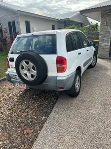
RAV 4
 Automatic Aircon Good working condition Good interior and body New tinting
 -
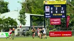
NTFL Womens Premier League 2024-25
 NTFL Womens Premier League 2024-25
 -
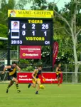
NTFL Games - Mens Premier 2025-2026
 NTFL Games for the Men's Premier 2025-2026 season. The Darwin football season runs from October to March while the southern states are in recess.


Darwin Community
Add your own Information or Comment on Articles in these Community Pages.
Community
- Art & Craft
- Clubs & Groups
- Community Forum
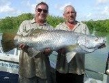
- Fishing
- Fishing Clubs
- Musicians
- Social Dancing
- Sports & Recreation
- Survival Guide
- Venues for Hire
Buy/Sell
History

 Community Banks® return profits to the community.